CORTEZ – Halfway through a quiet hurricane season, it’s too soon to relax, as experts are still predicting above-normal 2022 Atlantic hurricane activity.
Atmospheric and oceanic conditions still favor an above-normal 2022 Atlantic hurricane season, according to the National Oceanic and Atmospheric Administration’s (NOAA) annual mid-season update, issued this month by the Climate Prediction Center, a division of the National Weather Service. The hurricane season runs from June 1 to Nov. 30.
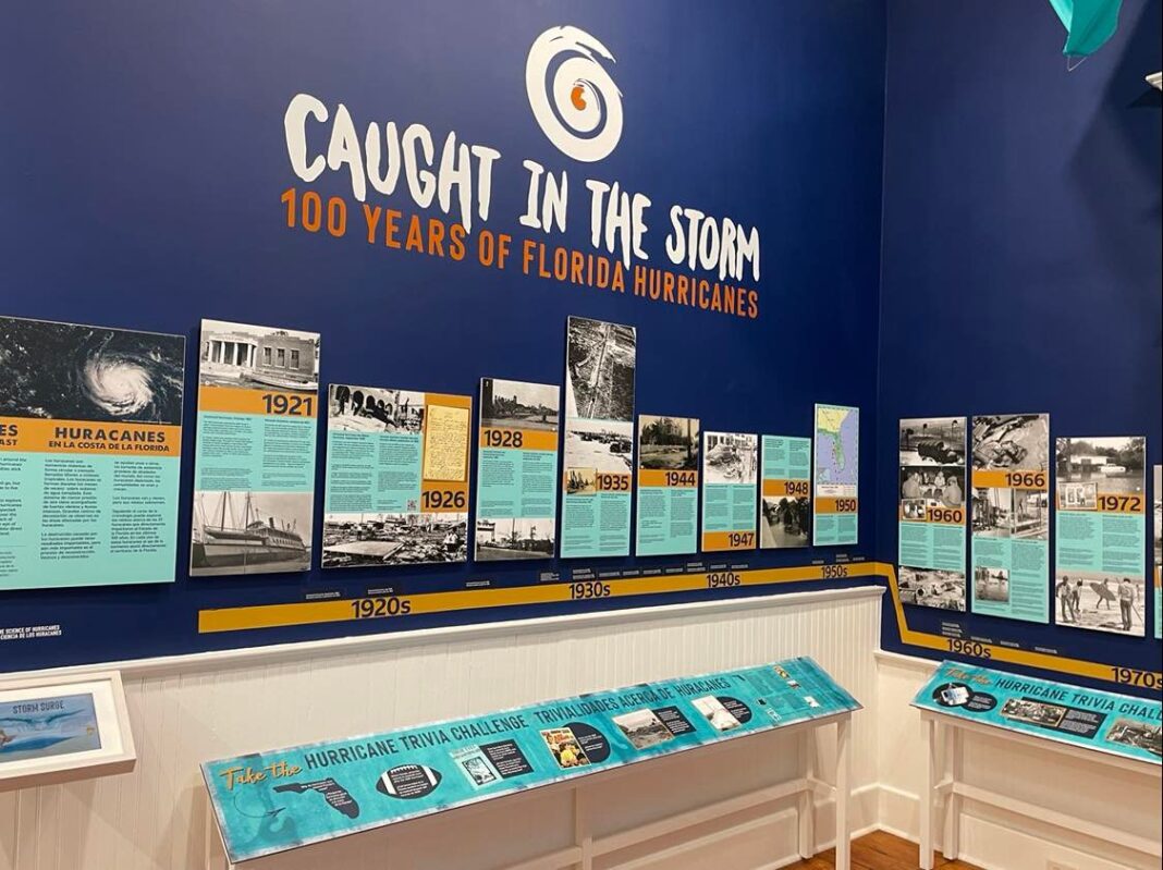
A timely rotating exhibit currently at the Florida Maritime Museum (FMM) titled “Caught in the Storm: 100 Years of Florida Hurricanes” revisits some of the worst coastal storms to impact the state – several of which hit locally.
An unnamed hurricane in October 1921 covered the Gulf coast in water from Fort Myers to Tarpon Springs, causing devastation to the Cortez waterfront.
“In Cortez, fishermen watched their industry be nearly swept away. The storm’s waves left behind mounds of debris tangled in nets where fish camps and docks once stood,” according to the FMM exhibit. “Left without markets to sell to, the fishermen created their own, some of which still remain on Cortez’s waterfront.”
The Cortez Public School, which still stands at 119th Street West and Cortez Road and is now the Florida Maritime Museum, is the highest point in Cortez and was used as a shelter during that storm, which had an 11-foot storm surge.
In October 1944, a major unnamed hurricane known unofficially as the Cuba-Florida Hurricane “struck the Bradenton/Sarasota area causing trees to fall across the road taking out power lines and disrupting all communications between the Keys and the mainland.”
Hurricane Alma in June 1966 was another storm highlighted in the exhibit, with the following recollection from Cortez resident August Antilla, “…by nightfall Ellen and I had purchased $12 worth of cheeses, cold cuts and candy, and we were looking forward to our cozy hurricane party, just the two of us. The radio was blaring continually… ‘Evacuate, Anna Maria Island. The tide will be 7 to 11 feet above normal.’ ”
The largest hurricane evacuation in U.S. history happened just five years ago in September, 2017 with 6.5 million people fleeing their homes in anticipation of Hurricane Irma. Hurricane track predictions included a “cone of uncertainty” with Irma; that cone covered the entire Florida peninsula. In an abundance of caution, many counties issued mandatory evacuation orders.
So far this year, the season has seen three named storms – Alex, Bonnie and Colin – and no hurricanes in the Atlantic. An average hurricane season produces 14 named storms, of which seven become hurricanes, including three major hurricanes.
NOAA forecasters have slightly decreased the likelihood of an above-normal Atlantic hurricane season to 60% from the May prediction of 65%, but more than 60% of hurricanes that make landfall do so after the peak of the season in September.
“We’re just getting into the peak months of August through October for hurricane development, and we anticipate that more storms are on the way,” NOAA Administrator Rick Spinrad said.
“I urge everyone to remain vigilant as we enter the peak months of hurricane season,” U.S. Secretary of Commerce Gina Raimondo said.
For more information, check out The Sun’s Hurricane Guide.


