


BRADENTON BEACH – Building Official Steve Gilbert’s review of the city’s 1989 comprehensive plan and 1990 land development code (LDC) may help resolve an existing land use concern.
The residential properties in the Azure Shores subdivision are located between Bridge Street and the Cortez Bridge, and Highland Avenue and Gulf Drive South. The properties carry R-3 (multiple-family dwelling district) zoning designations and retail/office/residential (ROR) future land use designations. Until recently, Gilbert and Serna felt the R-3 zoning and the ROR future land use designations were not consistent with one another according to city code.
In 2019, the city commission directed Gilbert and then-City Planner Alan Garrett to resolve citywide inconsistencies that exist between the city’s zoning map and the city’s future land use map – and the zoning and land use designations that accompany those maps.
The inconsistencies date back to 2008 when the city commission amended the future land use map but didn’t amend the corresponding zoning map. Gilbert and City Attorney Ricinda Perry have stated the existing inconsistencies create conflicts that could expose the city to legal challenges from developers and/or neighboring property owners.
In 2021, Gilbert, City Planner Luis Serna and the planning and zoning board began discussing the map inconsistencies that exist throughout the city. In 2022, they began focusing solely on the Azure Shores subdivision as the first of many areas to be addressed.
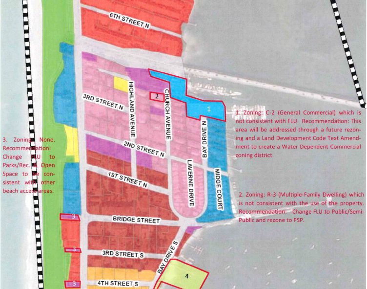
In October 2022, the city commission rejected Gilbert and Serna’s recommendation to apply a mixed-use district (MXD) zoning designation to the Azure Shores properties while maintaining the ROR land use designation. The mixed-used designation would have allowed ground-level retail and commercial activities to take place on those residentially-zoned properties and the commission rejected that idea.
During that same meeting, the commission also rejected the planning and zoning board’s contrasting recommendation to instead rezone those properties to R-2 (two family dwelling) and change the future land use map designation to medium density residential. City Attorney Ricinda Perry told the commission that downzoning those properties from R-3 to R-2 could subject the city to legal challenges from those property owners.
New solution proposed
On May 3, Gilbert and Serna presented the planning board with an alternative means of curing the Azure Shores map inconsistencies. The proposed solution was included in the staff memo the board members received before the meeting.
The memo included the following recommendation: “Revise the text of the comprehensive plan and land development code so the existing R-3 zoning district would be consistent within the existing ROR future land use category. This option would address the current inconsistency but would allow rezonings to R-3 in the ROR category. The advantage of this option is that it would not result in any changes to the character of Azure Shores by rezoning the property and would not expose the city to any potential takings claims.”
During the May 3 meeting, Gilbert said the Azure Shores map inconsistencies could be cured simply by amending the text in the land development code and the comprehensive plan in a manner that states the existing R-3 zoning designation can be implemented in the city’s only ROR zoning district.
“We don’t change future land use; we don’t change the zoning. We just add text in the comp plan and LDC so that R-3 is an implementing use in the ROR land use category,” Gilbert said.
He said the city’s future land use and zoning summary table would also have to be modified in a corresponding manner by moving the R-3 implementing zoning out of the high-density residential future land use category and into the ROR future land use category instead.
Gilbert said this potential solution emerged from his recent research of the 1989 comprehensive plan adopted in 1989 and the 1990 land development code.
“What I discovered is that what we thought was a new land use assignment in 2008 on the future land use map indicating ROR for Azure Shores was not in fact a newly-designated land use. For Azure Shores, the land use did not change in 2008.” Gilbert told the planning board.
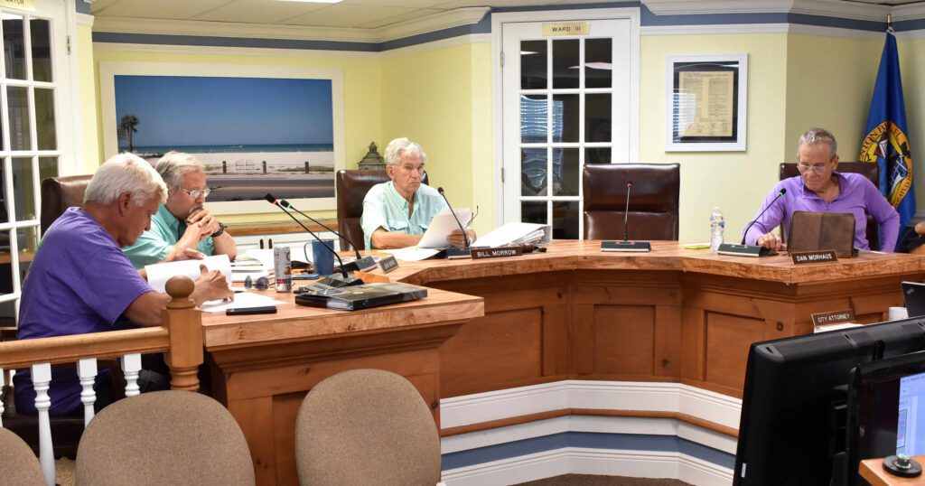
Planning and Zoning Board members Fred Bartizal, John Burns, Bill Morrow and Dan Morhaus participated in the May 3 meeting. – Joe Hendricks | SunIn response to questions posed by the planning board members, Gilbert and Serna said the proposed text amendments would maintain the current 35% lot coverage and 40% impervious surface requirements for those residential properties and would not allow the 90% lot coverage allowed in the nearby Bridge Street Commercial Overlay District. He also said the proposed change would still not allow a hotel or motel to be built or operated in the Azure Shores subdivision.
The planning board unanimously supports the proposed solution and asked Gilbert and Serna to draft the proposed text amendments to be discussed at the board’s June 7 meeting, or soon thereafter.